

Familiar Podhale and Spisz
Location:
Polska
Category:
medium
Distance:
55 km
Start:
Nowy Targ, inne (pętla)
End:
Nowy Targ, inne (pętla)
Gpx:
Rodzaj nawierzchni:
asfaltowe ścieżki rowerowe
drogi publiczne
Rodzaj roweru:
SPD - trasy odpowiednie dla każdego rodzaju roweru, tzn. szosowego, crossowego i górskiego/MTB
TRK - trasy odpowiednie dla roweru crossowego i górskiego/MTB
Does the Dunajec river flow to the Danube river? Is the church in Dębina made of oak? How old are the oldest orchestral bells? And what about the oldest boomerang? Is Białka white? Why are Pieniny not Beskidy, and Bór na Czerwonem is not actually red? Answers to these questions can be found on this trip. Moreover, a lot of picturesque views, interesting monuments, and hands-on geography and biology lessons.
Approximately 90% of the route far from the car trafficTotal length: 55 kmTotal ascent: 430 mRiding time (without breaks): 3 h 50 minRequired experience: ModerateNecessary physical fitness: LowStart and end: Nowy Targ, other (loop)Access: Car, train (Nowy Targ Railway Station)
Notes:Suitable for kids on the bikes90% of the route far from the car trafficAround 1 km along the voivodeship road!
Main attractions of the route:
Velo Dunajec Nowy Targ - Knurów: a comfortable trip along the quiet river area, to slowly enjoy the day.Dębno Podhalańskie: the church from the times of the Jagiellonian dynasty and the 1500 years old orchestral bells! Medieval art and architecture do not have to be boring.Krempachy, Dursztyn, Frydman: why do they have such strange names?Sheep and landscapes of Dursztyn: culture and geography lesson. Wherever you look, the mountains are different.Bór na Czerwonem: a sponge on a macro scale. Peatland - what is it?
Description:We start the trip close to the banks of Dunajec in Nowy Targ. The river and the Velo Dunajec trail will accompany us through the first part of the journey. The Velo trail runs along a picturesque and little-known part of the river, which is not as spectacular here as it is at the Gorge, however, it still has its charm, flowing slowly and peacefully.
A bit of a lazy ride ends in Knurów, where, to avoid the voivodeship road, we go into the mountains, on the local road through Szlembark. The ascent is noticeable, however, it rewards us with vast views.
After the downhill part, WATCH OUT, we get to the voivodeship road for around 1 km, just to run away from it at the earliest opportunity, into the streets of Dębno. Something unique can be found here.
The church in Dębina is over 500 years old, and the modest orchestral bells at the altar can be even… 1500 years old! The polychrome paintings on the walls may not be as bright and lively as movies or animations, but remember, that they are a few centuries old!
Behind Dębno, we continue towards Nowa Biała and Krempachy, two villages with the buildings characteristic for the Spiš area - the houses located along the parallel roads, with the church in the middle and barns in the back. It results from a slightly different history of these lands. Until 1918, the area was owned by… Hungary, where the regulations were different. Does nowadays Poland have a border with Hungary? The Slovakians in Poland Society reside in Nowa Biała. Do you know what the word “Potraviny” on the shop’s window means?
In Krempachy, the route leads up, more and more steep and difficult, however, the beautiful views it rewards us with allow us to forget about the tiredness and sore legs. And for the persistent, there’s a prize - delicious views from Wichrówka, the hill over Dursztyn, or maybe simply… ice cream in Dursztyn?
Dursztyn, Krempachy, Frydman, Trybsz - those are some weird names. They indicate that the Germans were also a part of Spiš’s history (because we are back in Spiš). Many villages, after the Tatar attacks (13th century), were established once again by the Saxonian settlers.
After reaching Wichrówka, you can sit down, have a good look at the Tatra mountains, and listen to sheep’s bells (access to the shepherd's hut on the road from the church, watch out for the dogs!). You can clearly see here, how different the mountain ranges are. They are made from different types of rocks. From Dursztyn, we come back the same way, downhill.
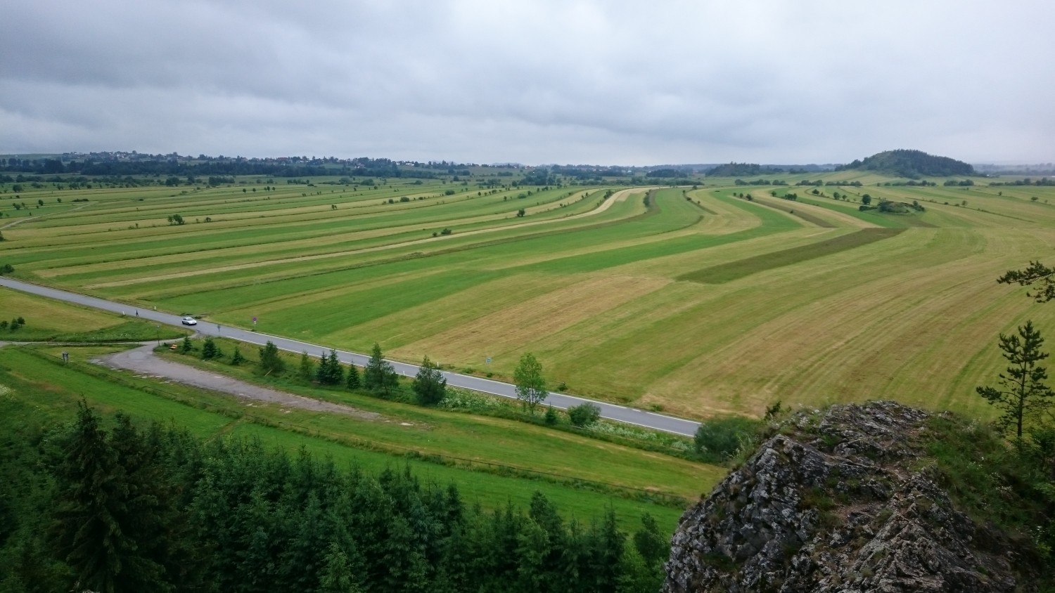
Behind Nowa Biała, the route guides us among the fields and pastures, and after passing Gronków, we get to the gravel part of the route through the Bór na Czerwonem reserve.
It is a reserve created to protect the peatlands. They are a natural sponge, they retain a lot of water. They are very unique and distinguishable by their extraordinary flora (plants), including the carnivorous sundew.
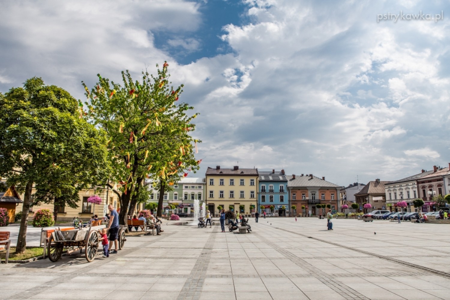
After going through Bór na Czerwonem, we cross the Dunajec river and we go back to where we started. For ice cream lovers, there are many ice cream parlours on the square in Nowy Targ.
Share


Project’s Partners


Portal Co-Financed By The European Union From The European Regional Development Fund Under
The Interreg V-A Pl-Sk Cross-Border Cooperation Program 2014-2020

Portal modernization co-financed by the Ministry of Development
