06.UP THROUGH THE HILLS OF ORAVA
Location:
Polska
Category:
easy
Distance:
28 km
Start:
JABŁONKA
End:
JABŁONKA
Gpx:
JABŁONKA – Zubrzyca Dolna – scenic road to Marszałkowa – Podwilk – Bukowiński Stream Valley – Podszkle – long downhill ride along the scenic ridge Studzianki andMachajowa – JABŁONKA
Orava is undoubtedly a paradise for mountain bike lovers, but let's not be afraid – this route is also very good for trekking bikes. It surprises us with great open spaces, vast fields, forests, unexpected panoramas with the Babia Góra Peak and the Tatras in the background. In the villages and hamlets scattered here and there we can also find interesting monuments and lost roadside shrines. A trip for those attracted by little-known places who want to get away from it all.
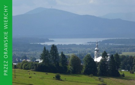
The route starts in the capital of the Polish section of Orava – Jabłonka, next to the church, which definitely dominates not only the village, but also the surrounding area, offering magnificent views of the Orava Forest (peat bogs) and the backdrop of the Tatra Mountains. From Jabłonka, we head towards Zubrzyca Dolna. On the road, keep an eye out – cars drive here at high speed. After Jabłonka, we pass a shrine in the fields, and then, between the buildings, a shrine typical of Orava originating from Oravský Biely Potok, a village now situated in Slovakia, formerly famous for stone-masonry. From the main road we go to a side road, and a little further we turn into a local road connecting Zubrzyca with Podwilk. We enter extraordinary landscapes4, full of fields and meadows, with the dominant Babia Góra massif. With the road descending gently, we come to Marszałkowa, a Podwilk hamlet. Here, we enter the main road (DK7), but only for 0.5 km, then we run to the Pieronki hamlet and continue on a gravel road to the mouth of the forested valley of the Bukowinski Stream along which we will ride for another 6.5 km. To our surprise, we suddenly lose the asphalt surface and for over 2 km there is a wide dirt track (asphalt planned from Sep. 2020), still remaining the main access road to the village of Podszkle which lies higher up. After reaching it, before coming to the centre and the church, we turn right on to a small road to the hamlet of Studzianki. We are in the source areas of the Czarna Orawa River, and therefore the Black Sea basin, not that of the Baltic Sea. There is still 1.5 km of painless ride to cover, but we will be rewarded with an extremely long, pleasant and scenic descent all the way to Jabłonka. At first, through desolate forest areas, with a short gravel break, we cycle down the comfortable and unfrequented asphalt road to the scenic hamlets of Dziedzicowa and Szklarzy. Along the way we pass two peculiar elements of the local landscape: Loretto shrines – the wooden "turrets" at which people prayed; they also served, through their bells, as a warning and protection signal against upcoming thunderstorms and informed folk about fires. We will probably spend the last stretch of the descent to Jabłonka by twisting our necks to the left – the view of the vast forest peat bogs is truly phenomenal from here. In good visibility we can see the Tatra Mountains in the background, while behind the church in Jabłonka we can see Lake Orava.

Project’s Partners


Portal Co-Financed By The European Union From The European Regional Development Fund Under
The Interreg V-A Pl-Sk Cross-Border Cooperation Program 2014-2020
Portal modernization co-financed by the Ministry of Development

